
Beyond Half Dome: Five Yosemite Secrets
ByRobert Reid
November 18, 2015
6 min readYosemite National Park is about as big as the state of Rhode Island (both are roughly 1,200 square miles). Despite the park’s size, most people who visit make a beeline for one place, the Yosemite Valley, and confine their exploration to this mile-wide, 7-mile-long canyon cut by the Merced River.
Sure, Yosemite Valley is more than worth visiting—and home to Yosemite icons such as Half Dome, El Capitan, and Bridalveil Fall. But if you leave after that, you’d be missing out on 99 percent of the park.
Tioga Road—the stretch of California State Highway 120 that bisects Yosemite, running east-west just north of the valley—is open seasonally (depending on snowfall) and provides access to lesser-known, but equally rewarding, park landmarks.
Originally a wagon road built for miners in the 1880s, this stunning high-elevation route ascends into an alpine wonderland of snowy peaks, pristine lakes and meadows, and towering trees.
And though Yosemite’s high-country highlights involve a bit of hiking to see, most of them can be reached fairly easily, even by those with limited experience on the trail.
Here are five of my favorite park secrets—accessible on foot from Tioga Road—from west to east:
1. Giant Sequoias (2 miles roundtrip)
Visitors intent on seeing the largest trees on Earth, which are found only on the Sierra Nevada’s western slope, tend to head for Mariposa Grove, near the park’s southern entrance. But this grove, one of three in Yosemite where giant sequoias can be found, is the subject of a long-term restoration project and will be closed until the spring of 2017.
That makes Tuolumne Grove your best bet for getting up close and personal with these ancient redwoods.
From the parking lot, a narrow road that was closed to vehicles in the 1990s slopes down through a thick forest. After about a mile’s walk, you’ll reach the grove, which includes a handful of towering sequoias, including a massive stump with a carved-out tunnel that you can walk through. Word of warning: It’s a bit of a steep trek out.
Tip: The parking lot is located off Tioga Road, about a half mile east of its intersection with Big Oak Flat Road.
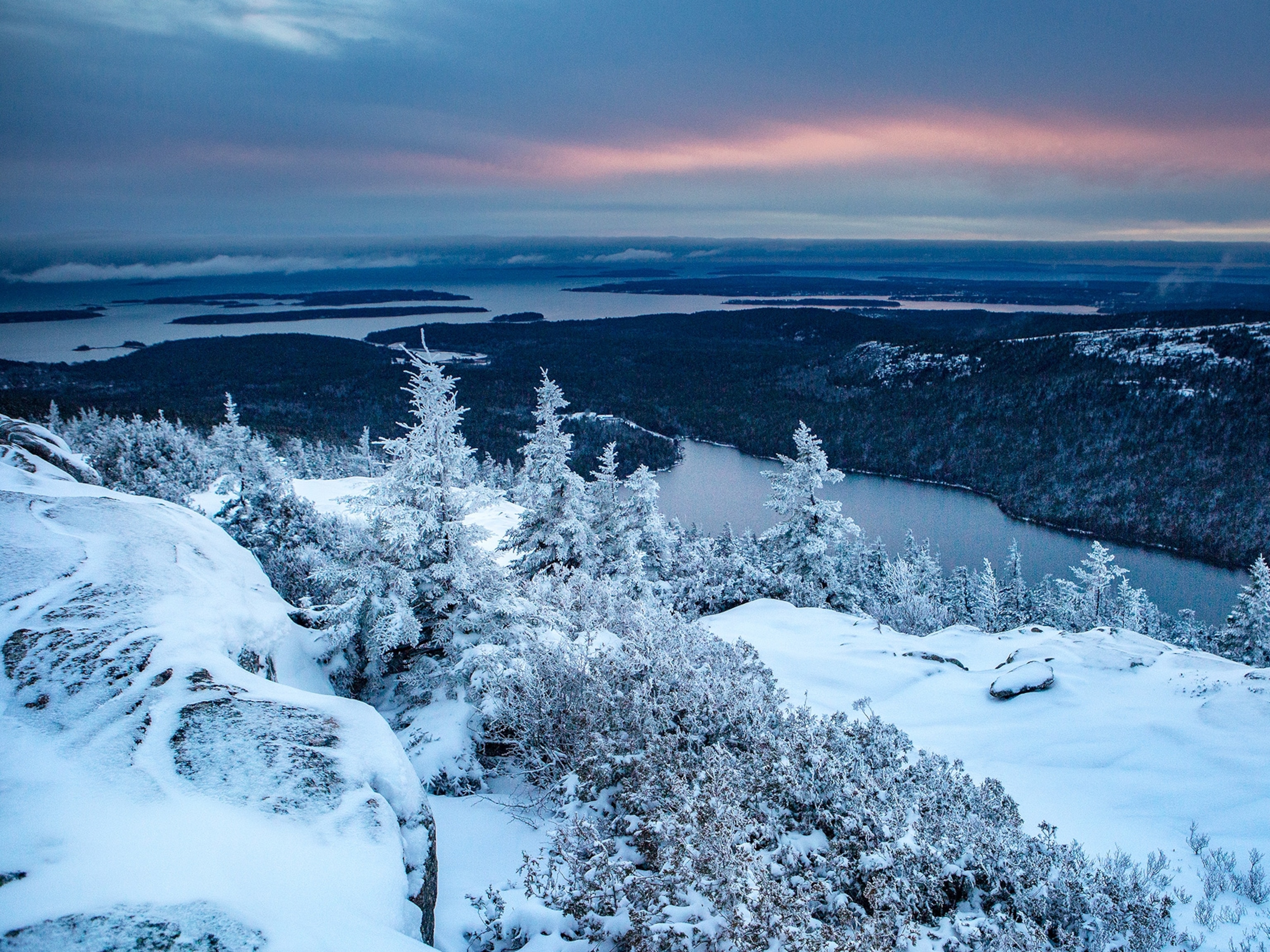
2. May Lake (2.5 miles roundtrip)
A thrilling, single-lane section of what is now known as the “Old Tioga Road“—left behind when the Tioga Road was realigned to avoid Aspen Valley in the western part of the park—offers a tempting detour from Highway 120. It also provides relatively easy access to May Lake, a picnicker’s dream at Yosemite’s geographic center.
This semi-steep trek to the lake is the perfect choice for those looking for a scenic hike, but who don’t want to spend the whole day on the trail. John Degrazio, a backcountry guide with YExplore, told me it’s “the biggest bang for your buck” in the park. And most people miss it.
Is it merely a coincidence that the subalpine lake lies at the base of 10,855-foot Mount Hoffmann? Topographer Charles F. Hoffmann, a member of the team that surveyed the Sierra Nevadas in the mid-19th century, named the lake for a woman he was hoping to woo. She eventually became his wife.
3. Olmsted Point (0.5 mile roundtrip)
There’s no excuse to pass the trail leading to Olmsted Point—named for the architect Frederick Law Olmsted, of Central Park fame, and his son—without stopping.
Just a quarter mile from the parking lot, a path snakes between junipers, rising up to a broad rock face dotted with enormous “erratics” (that is, boulders left behind by retreating glaciers). It’s fun and easy to scramble across what looks like a game board giants left behind.
And then there’s the view. Olmsted Point looks out over Tenaya Canyon and Yosemite Valley in the distance, providing an unusual look at Half Dome. Look closely, or you might not recognize the famous peak.
4. Pothole Dome (2.5 miles roundtrip)
A couple of miles past Tenaya Lake lies a mound of rock that gives hikers of all skill levels the chance to “claim a dome.”
Far less ambitious a climb than nearby Lembert Dome (or, somewhat obviously, the Valley’s Half Dome), Pothole Dome delivers significant scenic payoff in exchange for relatively little work.
From the top, look east over Tuolumne Meadows, a landscape dominated by glaciated granite bedrock and sinkholes formed in the Ice Age, and at Cathedral Peak far beyond.
5. Soda Springs (1.5 miles roundtrip)
In The Mountains of California, legendary naturalist John Muir offers a narrative, step-by-step guide to the Soda Springs that can still be followed today.
As mountain peaks fall from view, Muir asks his readers to pay attention to details: ribbon-leaved grasses, Clark crows, creeping liverworts, mats of dwarf willow, and a ground “littered with fallen trunks.”
Soon the path opens up into a wide meadow, where the brief hike’s reward can be found—a bubbling spring surrounded by a log enclosure.
Robert Reid is National Geographic Travel’s Digital Nomad, exploring the world with passion and purpose. Follow his adventures in Yosemite Country on Twitter and Instagram.
> Follow Robert’s Adventures in Yosemite Country:
- Beyond Yosemite: Outside-the-Park Must-Dos
- Three California Gold-Rush Towns Worth Visiting
- Channeling John Muir in Hetch Hetchy
You May Also Like


You May Also Like


Go Further
Animals
- Octopuses have a lot of secrets. Can you guess 8 of them?
- Animals
- Feature
Octopuses have a lot of secrets. Can you guess 8 of them? - This biologist and her rescue dog help protect bears in the AndesThis biologist and her rescue dog help protect bears in the Andes
- An octopus invited this writer into her tank—and her secret worldAn octopus invited this writer into her tank—and her secret world
- Peace-loving bonobos are more aggressive than we thoughtPeace-loving bonobos are more aggressive than we thought
Environment
- Listen to 30 years of climate change transformed into haunting musicListen to 30 years of climate change transformed into haunting music
- This ancient society tried to stop El Niño—with child sacrificeThis ancient society tried to stop El Niño—with child sacrifice
- U.S. plans to clean its drinking water. What does that mean?U.S. plans to clean its drinking water. What does that mean?
- Food systems: supporting the triangle of food security, Video Story
- Paid Content
Food systems: supporting the triangle of food security - Will we ever solve the mystery of the Mima mounds?Will we ever solve the mystery of the Mima mounds?
History & Culture
- Strange clues in a Maya temple reveal a fiery political dramaStrange clues in a Maya temple reveal a fiery political drama
- How technology is revealing secrets in these ancient scrollsHow technology is revealing secrets in these ancient scrolls
- Pilgrimages aren’t just spiritual anymore. They’re a workout.Pilgrimages aren’t just spiritual anymore. They’re a workout.
- This ancient society tried to stop El Niño—with child sacrificeThis ancient society tried to stop El Niño—with child sacrifice
- This ancient cure was just revived in a lab. Does it work?This ancient cure was just revived in a lab. Does it work?
- See how ancient Indigenous artists left their markSee how ancient Indigenous artists left their mark
Science
- Do you have an inner monologue? Here’s what it reveals about you.Do you have an inner monologue? Here’s what it reveals about you.
- Jupiter’s volcanic moon Io has been erupting for billions of yearsJupiter’s volcanic moon Io has been erupting for billions of years
- This 80-foot-long sea monster was the killer whale of its timeThis 80-foot-long sea monster was the killer whale of its time
- Every 80 years, this star appears in the sky—and it’s almost timeEvery 80 years, this star appears in the sky—and it’s almost time
- How do you create your own ‘Blue Zone’? Here are 6 tipsHow do you create your own ‘Blue Zone’? Here are 6 tips
Travel
- This town is the Alps' first European Capital of CultureThis town is the Alps' first European Capital of Culture
- This royal city lies in the shadow of Kuala LumpurThis royal city lies in the shadow of Kuala Lumpur
- This author tells the story of crypto-trading Mongolian nomadsThis author tells the story of crypto-trading Mongolian nomads
